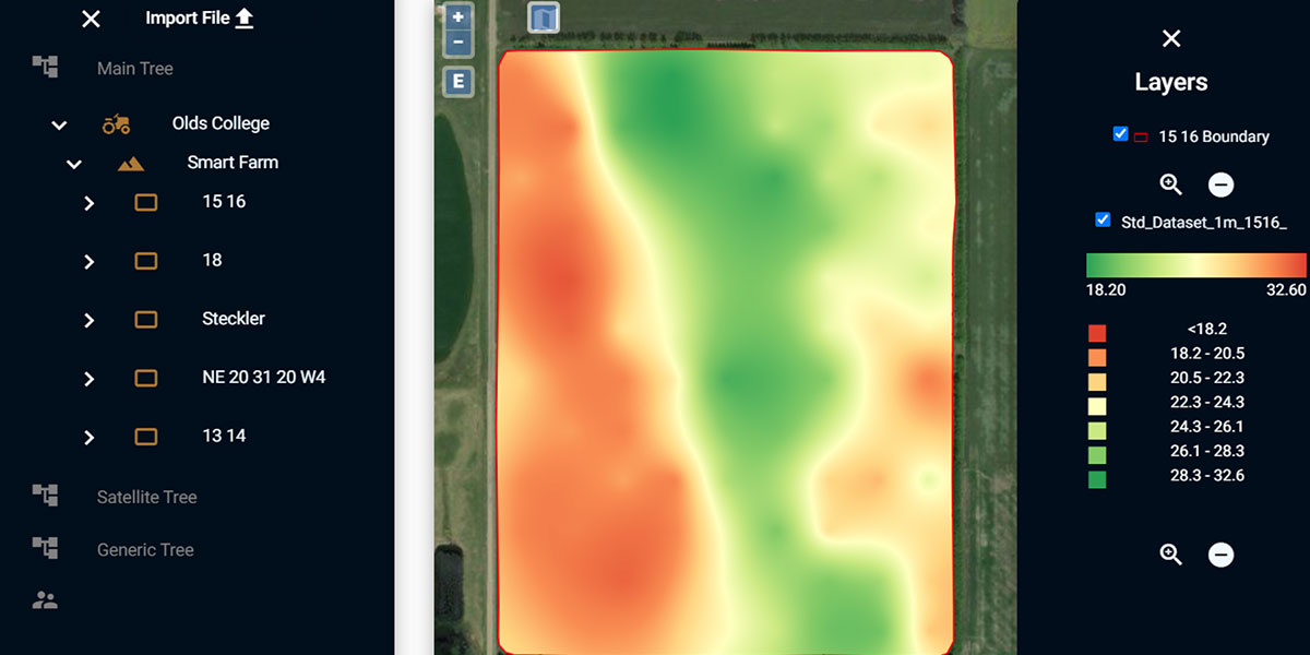
The HyperLayer Data Concept is a process that allows the Olds College Smart Farm to compile, analyze, and use virtually every type of agricultural data. It centers around compiling topographical data, detailed soil nutrient and moisture mapping, multispectral and hyperspectral imagery, yield data, and other layers of information to assist in machine learning for easy analysis, data extraction, and building next-generation analytical algorithms.
The next generation of digital farming technologies, based on machine learning (ML) and artificial intelligence (AI), requires comprehensive training datasets with geographical coordinates. The main difficulty is that various types of information comes from different sources and in different formats. Even classical types of statistical analysis, such as correlation, regression etc., require data to be standardized and stored in the same format.
The HyperLayer Data Concept means that for each field on the Smart Farm, there will be multiple layers of data collected and used for analysis, building new ML algorithms, development and validation of new technologies. Various types of Ag data always have geographical coordinates and are stored in the same standardized georeferenced format in the same database. This allows for quick extraction of data, easy analysis and data sharing and a unique opportunity to put together, overlay and analyze interrelations for virtually every type of geospatial Ag data that exist in the industry.
Partners/Funders: CAAIN, CFI/RCP, FarmVu, NSERC, PrairiesCan, TELUS, xarvio/BASF